Hurricane Wilma

Sharky

New Member
As of 0300 CDT 10/19/2005, Hurricane Wilma reached Category 5, with a minimum pressure of 892mb and surface winds of 175 mph. By daybreak this hurricane has the potential to be the strongest hurricane ever recorded. Watch this one carefully, folks - it should be very interesting.

It's a little early for track predictions but they are currently guessing that once it enters the Gulf of Mexico it will hook around to the northeast and cross the tip of the Florida peninsula just south of Ft. Myers.

For more information visit: National Hurricane Center / Tropical Prediction Center

These images refresh automatically and will present the most current information available.


5 Day Tracking Cone
050646W_sm.gif


Hurricane Force Wind Probability (74 mph or higher)
050646.gif


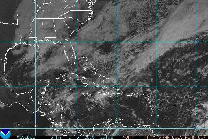
Visible Satellite Image
HUVS.JPG
 
Data buoy observations (surface wind speed, wave height, etc.) for the current (Wednesday) location of the storm can be found here and here.

Once the storm approaches Florida you can select a buoy from this chart.
This buoy
would be a good one to check.
 
Okay, the hurricane hunter's recon aircraft just reported an extrapolated minimum pressure of 881mb, which could make Wilma the strongest Atlantic hurricane ever recorded (the previous record was Gilbert at 888mb).

Of course, this is an unconfirmed report.

NHC/TPC said:
UNOFFICIALLY...THE METEOROLOGIST ON BOARD THE PLANE RELAYED AN
EXTRAPOLATED 881 MB PRESSURE AND MEASURED 884 MB WITH A DROPSONDE.
THIS IS ALL IN ASSOCIATION WITH A VERY SMALL EYE THAT HAS BEEN
OSCILLATING BETWEEN 2 AND 4 N MI DURING EYE PENETRATIONS. THIS IS
PROBABLY THE LOWEST MINIMUM PRESSURE EVER OBSERVED IN THE ATLANTIC
BASIN AND IS FOLLOWED BY THE 888 MB MINIMUM PRESSURE ASSOCIATED
WITH HURRICANE GILBERT IN 1988. HOWEVER...ONE MUST BE VERY CAREFUL
BEFORE IT IS DECLARED A RECORD MINIMUM PRESSURE UNTIL A FULL AND
DETAILED CALIBRATION OF THE INSTRUMENTS AND CALCULATIONS IS
PERFORMED. SO PLEASE DO NOT JUMP INTO CONCLUSIONS YET...BE PATIENT.

The rest of the discussion:

NHC/TPC said:
WILMA IS A CATASTROPHIC CATEGORY FIVE HURRICANE THAT IS MOVING OVER
VERY WARM WATERS...TYPICAL OF THE NORTHWESTERN CARIBBEAN SEA...AND
WITHIN AN ENVIRONMENT OF LIGHT SHEAR. HOWEVER...DESPITE THE
FAVORABLE LARGE SCALE ENVIRONMENT...WILMA IS NEAR ITS MAXIMUM
POTENTIAL INTENSITY AND FURTHER STRENGTHENING IS NOT ANTICIPATED.
MOST LIKELY...THE SMALL EYE WILL COLLAPSE FOLLOWED BY SLIGHT
WEAKENING OR SOME FLUCTUATIONS IN INTENSITY. EYEWALL REPLACEMENT
CYCLES WILL LIKELY CONTROL THE INTENSITY FOR THE NEXT 2 TO 3 DAYS
WHILE THE HURRICANE IS OVER THE NORTHWESTERN CARIBBEAN SEA.
THEREAFTER...ONCE WILMA REACHES THE SOUTHEASTERN GULF OF MEXICO AND
ENCOUNTERS THE WESTERLIES AND HIGH SHEAR...WEAKENING SHOULD BEGIN.

THE HURRICANE IS MOVING TOWARD THE WEST-NORTHWEST OR 295 DEGREES AT
7 KNOTS. IT SEEMS THAT DATA FROM THE HIGH ALTITUDE NOAA JET
INGESTED BY MODELS CAUSED THE TRACK GUIDANCE ENVELOPE TO SHIFT
SLIGHTLY WESTWARD FOR THE 2 TO 3 DAY PERIOD. HOWEVER...NO CHANGE IN
TRACK IS INDICATED OVER THE GULF OF MEXICO AND GUIDANCE CONTINUES
TO TURN WILMA SHARPLY TO THE NORTHEAST OVER FLORIDA. BASED ON THE
LATEST GUIDANCE...THE OFFICIAL TRACK FORECAST HAS BEEN SHIFTED
SLIGHTLY WESTWARD BUT IS KEPT ON THE EASTERN SIDE OF THE ENVELOPE.
THIS IN CASE THE TRACK GUIDANCE SHIFTS BACK TO THE EAST IN THE NEXT
RUN.

IN SUMMARY...THE OFFICIAL FORECAST BRINGS THE CORE OF THIS
CATASTROPHIC HURRICANE NORTHWARD THROUGH THE YUCATAN CHANNEL AND
THEN SHARPLY TURNS A WEAKER HURRICANE TO THE NORTHEAST TOWARD
FLORIDA WITH AN INCREASE IN FORWARD SPEED. NO CHANGE IN WARNINGS
OR WATCHES IS REQUIRED AT THIS TIME.
 
Sharky said:
cross the tip of the Florida peninsula just south of Ft. Myers.


That'd be us - It's time for this crap to go away - Can't stand the hurricanes anymore! :crying4:


go to luis's Flapper thingy and you'll see where abouts we are......
 
Mare said:
go to luis's Flapper thingy and you'll see where abouts we are......

or click my attachment :D


Mare thats a little close for our liking hon,do what you have to do to protect yourself and kiddies ,but try and let us know as soon afterward that all is well.:sadhug:
 
Whoa... just last night this ting was listed as a waffling 80mph cat 1. I didn't think hurricanes could jump from mild to wild in mere hours. Cat 3 in a day I can fathom... but all the way to 'strongest of all time'? Better check that storm for steroids.
 
These hurricanes are getting worse and worse. Mare, please make sure to take care of yourself and the family. I'll cross my fingers that by some miracle it changes and doesn't reach you and the speeds they are saying.
 
unclehobart said:
Whoa... just last night this ting was listed as a waffling 80mph cat 1. I didn't think hurricanes could jump from mild to wild in mere hours. Cat 3 in a day I can fathom... but all the way to 'strongest of all time'? Better check that storm for steroids.

When I left for work yesterday morning, the radio said it was just a tropical storm. On the way home, it had made H1 status. Now it's H5? I didn't even know that hurricanes could strengthen without the sun.
 
Professur said:
When I left for work yesterday morning, the radio said it was just a tropical storm. On the way home, it had made H1 status. Now it's H5? I didn't even know that hurricanes could strengthen without the sun.

It has more to do with water temperature than sunlight.
 
And here was me thinking it was some superhero flying in circles down there.

If you guys ever get tired of all the sunshine and great weather down there, it's only gonna be a few more weeks before we've got snow to share.
 
Coupled with the record rainfall last week (18 inches in 8 days), this is going to do quite a bit of damage.


Mare, hope you weather it ok with the kids.
 
unclehobart said:
Looks like a few Mexican resort towns are going to get erased by the side slap. Cancun no mas.

Yeah :eek:

I would not worry too much about that fancy city, it could be rebuilt relatively fast. I worry about poor people livinig on the coasts that could lose everything they have.
 
Mare said:
That'd be us - It's time for this crap to go away - Can't stand the hurricanes anymore! :crying4:


go to luis's Flapper thingy and you'll see where abouts we are......

Welcome to South Florida, hun. :sadhug:

This happens every year, it's just that this was a particularly prolific year for the storms. Who knows, next year there may only be two or three.

And hang in there - only 42 days left in hurricane season. :eh:

and thanks all the same, but I'd rather not go to Luis's "flapper thingy" :erm:
 
unclehobart said:
Whoa... just last night this ting was listed as a waffling 80mph cat 1. I didn't think hurricanes could jump from mild to wild in mere hours. Cat 3 in a day I can fathom... but all the way to 'strongest of all time'? Better check that storm for steroids.

Indeed. This one set a whole slew of new records, including a record for the fastest rate of strengthening ever recorded - a drop of 89 millibars of pressure in less than 5 hours. Some meteorologists are describing it as an enormous F3 tornado.
 
Back
Top